Identifying food deserts
Being able to acquire nutritious food close to where one lives is considered a key factor in healthy eating. Identifying areas where geographical access to nutritious food is poor enables us to act in these areas.
Definitions
Area with low access to nutritious foods: an area where the average distance between home and the nearest store offering nutritious foods is one kilometre or more in urban areas or sixteen kilometres or more in rural areas.1
Food desert: an economically deprived area characterized by poor access to stores offering nutritious foods.1
Mapping tool
This online mapping tool can be used to quickly identify areas with poor access to stores offering nutritious foods as well as food deserts across Québec.
To use this tool:
- Visit the Géoportail de santé publique: https://www.inspq.qc.ca/en/node/31290
- Click on the button

- Click on the burger menu on the left
 to display the menu;
 - Click on Thématiques / Environnements alimentaires;
- Click on the icon next to the chosen indicator, for example, the Indice de désert alimentaire. Coloured sectors will appear on the map;
- Move around the map to view the desired territory.
Interpretation
The following image illustrates an example of the mapping of access to stores offering nutritious foods in and around the City of Québec.
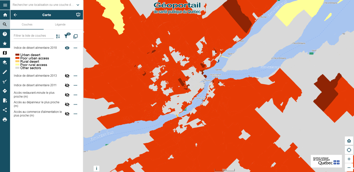
Areas in burgundy, red, orange or yellow on the map indicate a problem of geographical access to food stores offering nutritious foods in urban or rural areas, as the case may be.
The burgundy and orange areas are also considered deprived. As a result, they are food deserts. Priority of action should be given to these sectors, followed by areas with poor access, but which are not deprived.
Reference
- Robitaille, É., & Bergeron, P. (2013). Accessibilité géographique aux commerces alimentaires au Québec : Analyse de situation et perspectives d’interventions. https://www.inspq.qc.ca/es/node/3932